Geography
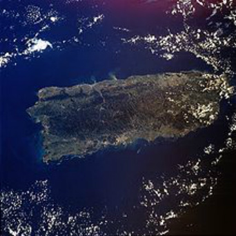 Arial View of Puerto Rico
The island of Puerto Rico is located in the Caribbean, between the Caribbean Sea and the North Atlantic Ocean, east of the Dominican Republic and about 1,000 miles (1,600 km) southeast of Miami, Florida.
Puerto Rico is almost rectangular in shape, approximately 100 miles long by 35 miles wide and is the smallest and the most eastern island of the Greater Antilles (Cuba, Hispaniola, Jamaica and Puerto Rico). It consists of the main island of Puerto Rico and several smaller islands and keys, including Vieques, Culebra, Culebrita, Palomino (known by some as the Spanish Virgin Islands), Mona, and Monito.
Its coastline measures approximately 580 km, and if the adjacent islands of Vieques and Culebra are included, the coast measures approximately 700 km. With an area of 3,425 square miles (9,104 sq km), Puerto Rico is the third largest island in the United States, and the 82nd largest island in the world.
